Austin Peay’s GIS Center partners with city of Springfield on water project
By: Colby Wilson July 31, 2025
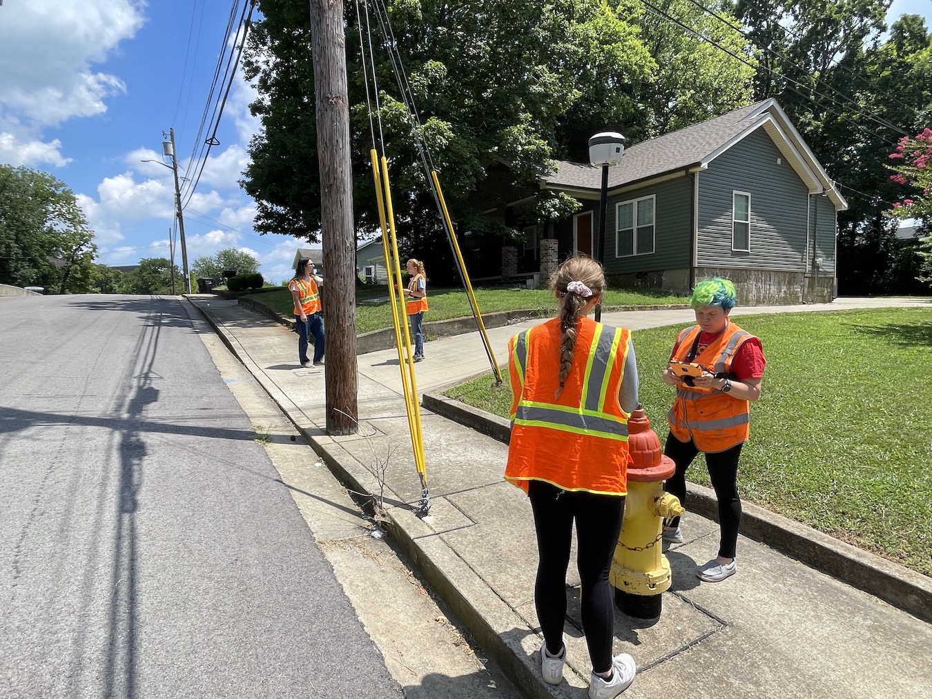
Student workers with APSU’s GIS Center work to map the city of Springfield’s water system as part of an extensive water infrastructure project. | Contributed photo
CLARKSVILLE, Tenn. — recently completed the first phase of a comprehensive water infrastructure mapping project for the city of Springfield, providing valuable real-world experience for students while delivering critical data to the municipality.
The project, which began in late Fall 2024, involved mapping Springfield's entire water system over a tight three-and-a-half-month timeframe. The GIS Center employed five student workers who spent their days in the field, meticulously documenting the location of water assets throughout the city and surrounding areas.
"The city already had some of their infrastructure in GIS or CAD (Computer-Aided Design) format, but they just didn't know what was truly correct," said GIS Center Project Manager Doug Catellier. "They were looking for a more accurate picture of what they actually have for asset management in their water systems."
The project's scope was extensive, covering an area stretching from near the Kentucky border to almost the Davidson County line. While they were initially focused on mapping within Springfield's city boundaries, the team's efficiency allowed them to expand their work to cover more of the utility's service area. A pivotal part of the project was digitizing the entire network, allowing the city to have an accurate and easily trackable map of its infrastructure in the future.
“Things change,” Catellier said. “A lot of times, these changes are reflected on paper, but in the digital mapping system it’s not. And if they don’t keep up and maintain something like that, a new development comes in and suddenly you don’t know what you have or maybe exactly where it is. It can hinder further growth and makes maintenance less efficient over time.”
For student workers like Zach Nesfeder, the project provided invaluable hands-on experience with industry-standard tools.
"It really helped with learning the technical side, using ArcGIS Pro, the online dashboard, and Field Maps," Nesfeder said. "We got a lot of practical experience going out into the field using the Trimble GPS units with Field Maps to accurately find points."
The fieldwork was physically demanding, with students regularly walking 8-12 miles daily through the city streets to document valve and hydrant locations.
"It's pretty fun to do as long as you're well-informed and wearing the right shoes," Nesfeder added.
GIS technician Alyse Heaston, who supervised student teams in the field, emphasized the value of learning through real-world application.
"Learning as you go and doing the actual work with real data is helpful instead of just doing practice data in small scale," Heaston said. "That's how I picked all this up in the first place was being thrown into a project."
The project exemplifies the GIS Center's dual mission of serving regional clients while providing students with career-building experience.
"We provide the client, in this case the city of Springfield, a service at a relatively low cost because we have students doing the work," Catellier said. "For the students, it's a benefit because they're gaining knowledge and experience that will help them after graduation."
Springfield officials were so pleased with the results that an agreement with the GIS Center for additional work in fiscal year 2026 is currently being ironed out. The updated GIS data will allow Springfield to maintain its water infrastructure more efficiently.
"By maintaining it, it's really making the department a lot more efficient," Catellier said. "There's a lot they can do with the GIS once they get it all built out. In the attribute data, you can have maintenance records as well."
Their success has also led to a similar contract with the city of Shelbyville. Projects like these allow the GIS Center to greatly enhance the student experience, giving them an opportunity to build skills and gain practical knowledge at a time when many of their peers have no more than classroom experience to work from.
“W±đ’r±đ going to provide them everything they ˛Ô±đ±đ»ĺ,” Catellier said. “Training, mentorship, everything. But once they’re out in the field, we want them to be able to utilize all that training to troubleshoot issues before they call us.”
About the Austin Peay College of STEM
The College of Science, Technology, Engineering & Mathematics (STEM) provides studies for students in the areas of agriculture, astronomy, aviation sciences, biology, chemistry, computer science, earth and environmental sciences, engineering physics, engineering technology, information technology, mathematics, medical laboratory sciences, radiologic sciences and physics. Our outstanding, discipline-based programs are student-centered and designed to prepare students for responsible positions at all levels of research, industry, education, medicine and government.