APSU’s Southeastern Grasslands Institute releases ‘open habitat’ status assessment, conservation plan for Cumberland Plateau
By: Eleanor Lopez April 23, 2026
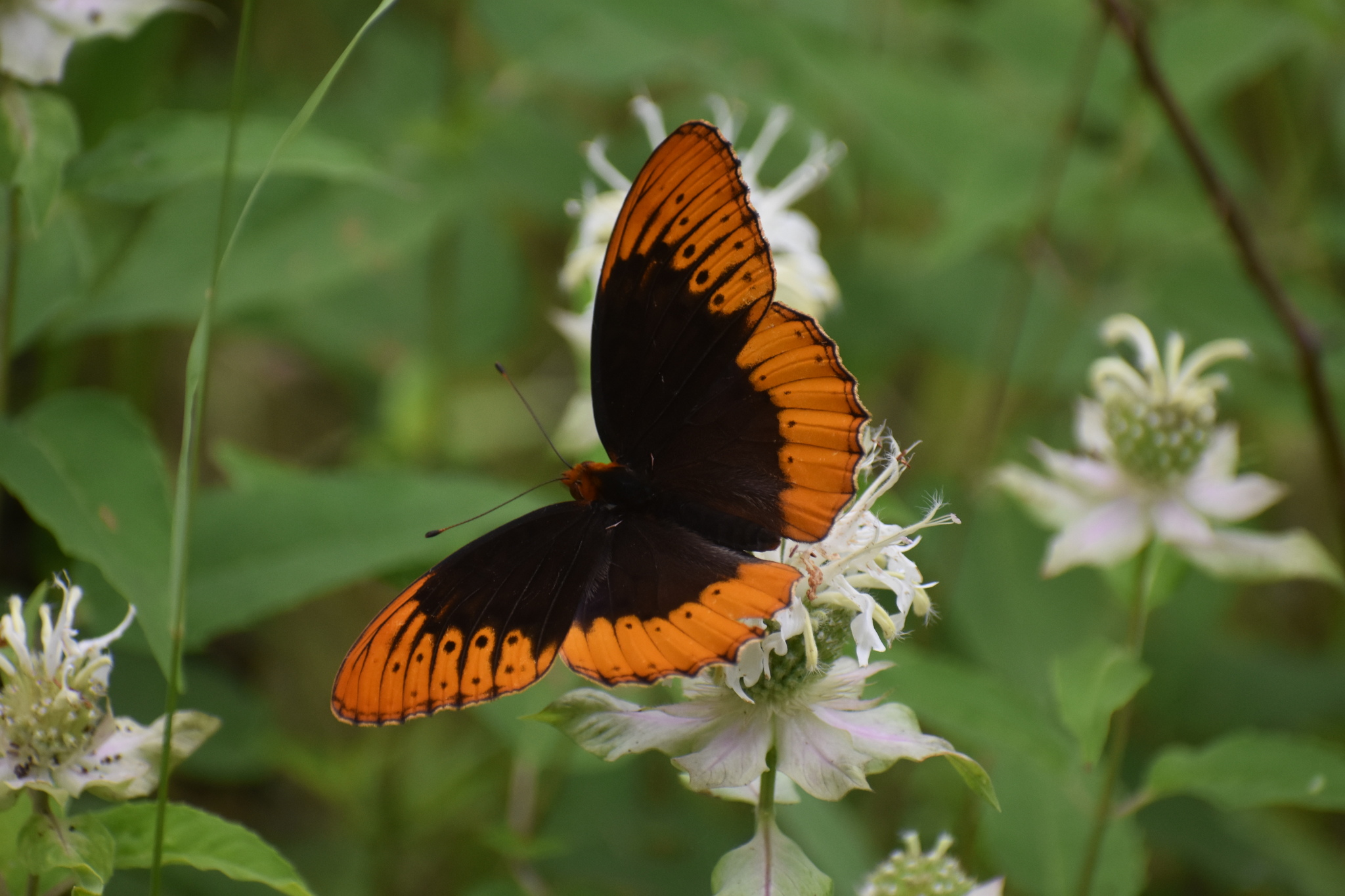
The Diana fritillary (Speyeria diana) is among the at-risk pollinator species that can be found in the Cumberland Plateau. The Southeastern Grasslands Institute aims to protect these ecosystems and support biodiversity. | Photo by Jared Gorrell
CLARKSVILLE, Tenn. – The first European explorers to cross the flat surface of the Cumberland Plateau recorded their rapture upon discovering large expanses of open savannas and woodlands, verdant native grasses, and deer, elk, and bison in abundance. What they found was the result of the interaction between unique plateau landforms and centuries of disturbance – by the large grazers and browsers and by fire (whether from lightning or Indigenous peoples).
Today, much of the Plateau is covered in dense forests—the result of fire suppression, land use change, and loss of large herbivores. These closed forests are inhospitable to many desirable, and declining, wildlife species—such as pollinators, songbirds, bobwhite quail, and bats—and even desirable trees, such as white oak and shortleaf pine. at Austin Peay State University, with support from the National Fish and Wildlife Foundation, recognizes the potential for restoring open, sunny habitats, such as woodlands and savannas, in historically open landscapes.
SGI recently conducted an analysis identifying approximately 28% of the Cumberland Plateau planning area as conservation targets, with 12% of these falling outside currently protected areas. The findings, were developed using the Ecological Zones (EcoZones) classification and mapping of historical vegetation to compare current and historical land cover at a 6-meter resolution.
The SGI team combined maps of these EcoZones with species distribution data for eight relatively wide-ranging focal grassland animal species and over 375 plant and animal species of conservation concern that rely on “open lands”. They then used spatial prioritization tools to develop a final recommended set of conservation opportunity areas (“megasites”) to prioritize for open ecosystem protection and restoration. The conservation targets and network design are flexible, based on the priorities of the organizations working on the Plateau and the range of target species and ecosystems in need of conservation.
“Our ultimate goal was to provide a comprehensive conservation vision for the Plateau that will help inform restoration and protection, priority-setting, and implementation,” said Dr. Reed Noss, chief science advisor to SGI.
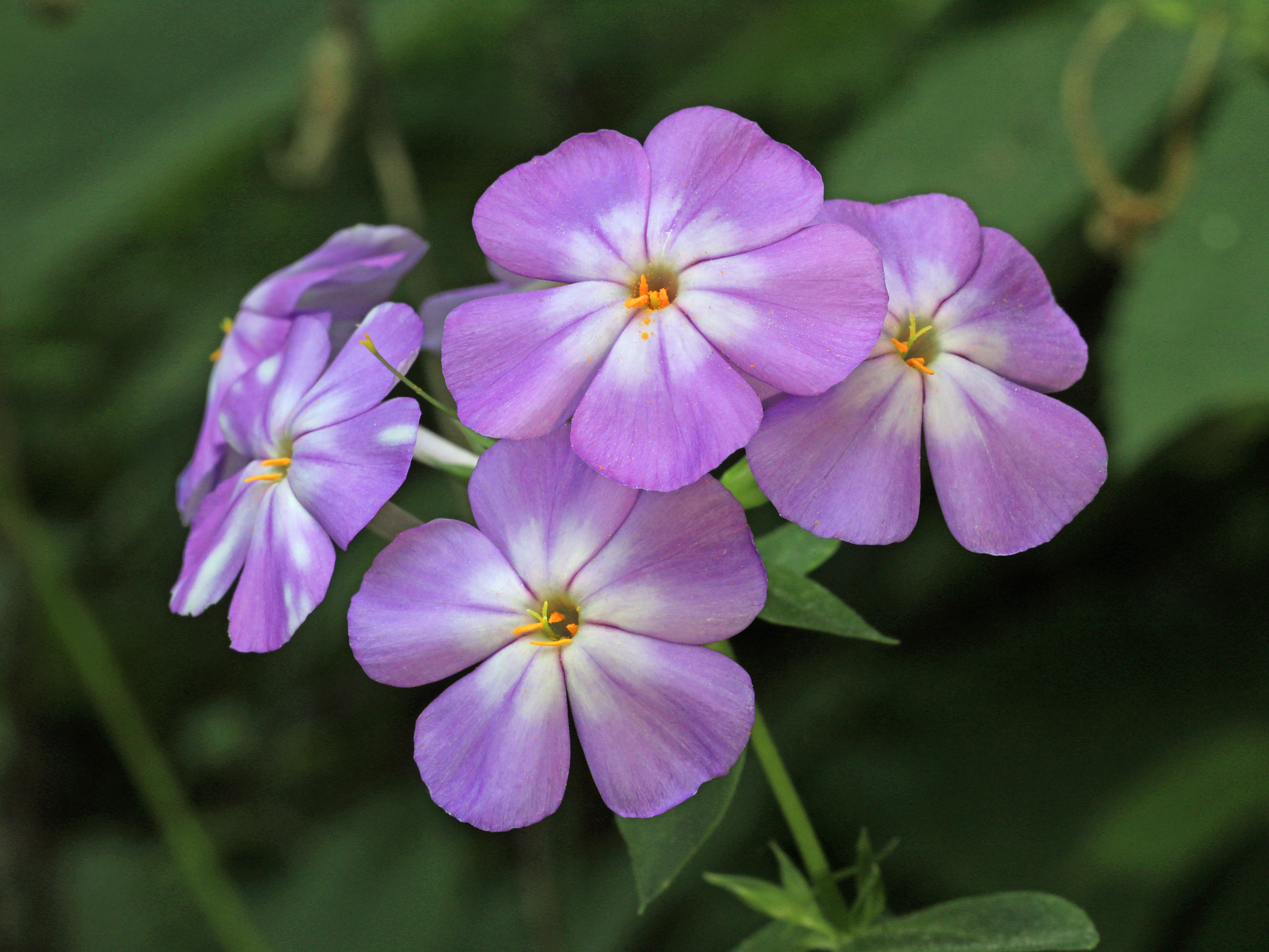
Cumberland Plateau grassland ecosystems are home to several at-risk plant species, such as the Alabama phlox (Phlox pulchra), which can be found in Alabama and blooms brightly during the summer. | Photo by Alan Cressler
Based on SGI’s findings, the restoration and management of open ecosystems within public and private protected areas is the primary conservation challenge, followed by conservation and restoration on private lands, partnering with willing landowners, through conservation easements and other mechanisms.
“While protection through an easement or government ownership is most secure, we recognize and deeply value the role private landowners can play in the resurrection of these beautiful landscapes,” said Dr. Dwayne Estes, SGI’s cofounder and executive director. “There are many conservation partners who participated in the development of this plan, and we have sought to provide them with tools they can use to further their work, including work with private landowners.”
The provides these tools directly to conservation partners and the general public. The full report can be viewed on . A fact sheet summarizing the report’s findings can be viewed .
“By hosting and sharing our data on the open-access Cumberland Plateau Strategy Assessment Web Viewer, we are not only supplying an argument for habitat protection and restoration, but the means to plan it effectively,” said Chip Morgan, GIS analyst for SGI.